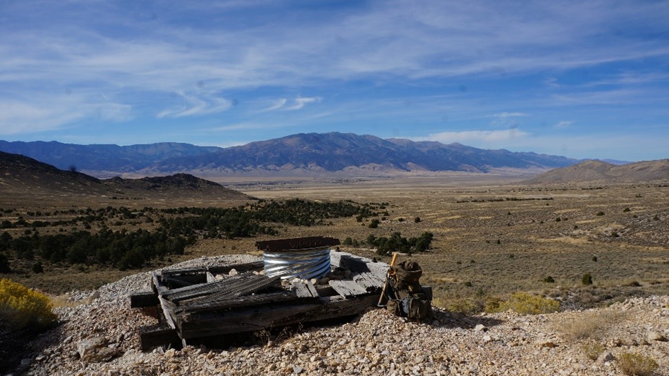
The Shamrock Property is 45 km east-southeast of Ely, Nevada in White Pine County. The property consists of 9 Federal Lode Claims staked on BLM land in Sections 17-20, Township 15N, Range 68E. There are no surface impairments. The property is readily accessible off Highway 50 north of Osceola.
The Shamrock Property is in the Sacramento Mining District. Gold and silver were first discovered there in 1869 and the Shamrock Property covers the two principal mines in the district. The Gilded Age Mine was staked in 1874 and produced intermittently from 1875 until 1948. The Woodman Mine was staked by Moses Woodman in 1897 and produced intermittently from 1898 until 1948. In 1948, the combined production from the two mines was the 9th largest in Nevada. Both mines ceased production the next year although there is evidence of more recent high grading at one site since then. During the 1930’s, production records show the two mines sent feed to a nearby mill in Osceola grading 1 ounce per ton gold and about the same in silver; copper grades were not reported. There are numerous workings of various vintage on the property including adits, shafts and stopes reaching surface. Silver Range examined the property in 2016 and staked it in May 2023. Silver Range has conducted preliminary sampling, orientation soil surveys and geologic mapping on the property.
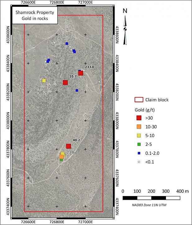
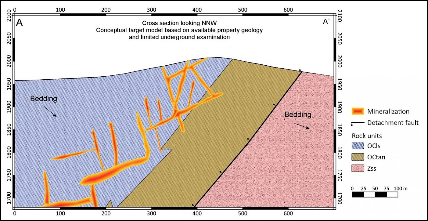
The Shamrock Property is underlain by Cambrian (Ordovician) Middle Part limestone and Upper Proterozoic to earliest Cambrian quartzite and phyllite. Both units dip moderately to the east-southeast and are separated by a major west-dipping detachment fault bounding the western flank of the Snake Range Metamorphic Core Complex. Discordant veins and breccia cut a blue-grey limestone underlying most of the property. These generally trend NNE or WNW and vary from steeply to gently dipping, forming a lattice work at property scale. Veins are up to 1 m wide in underground workings and consist of quartz with relict sulphides or their alteration products. Mineralized structures occur in an 800 m (N-S) by 300 m (E-W) area. Grab samples from vein and dump material collected at historic workings have assayed up to 233 g/t Au, 1,520 g/t Ag and 4.04% Cu. The mineralization appears to be carbonate replacement deposit (CRD) style with gold enrichment, suggesting deposition ahead of the marble front but proximal to an intrusive source.