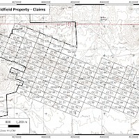
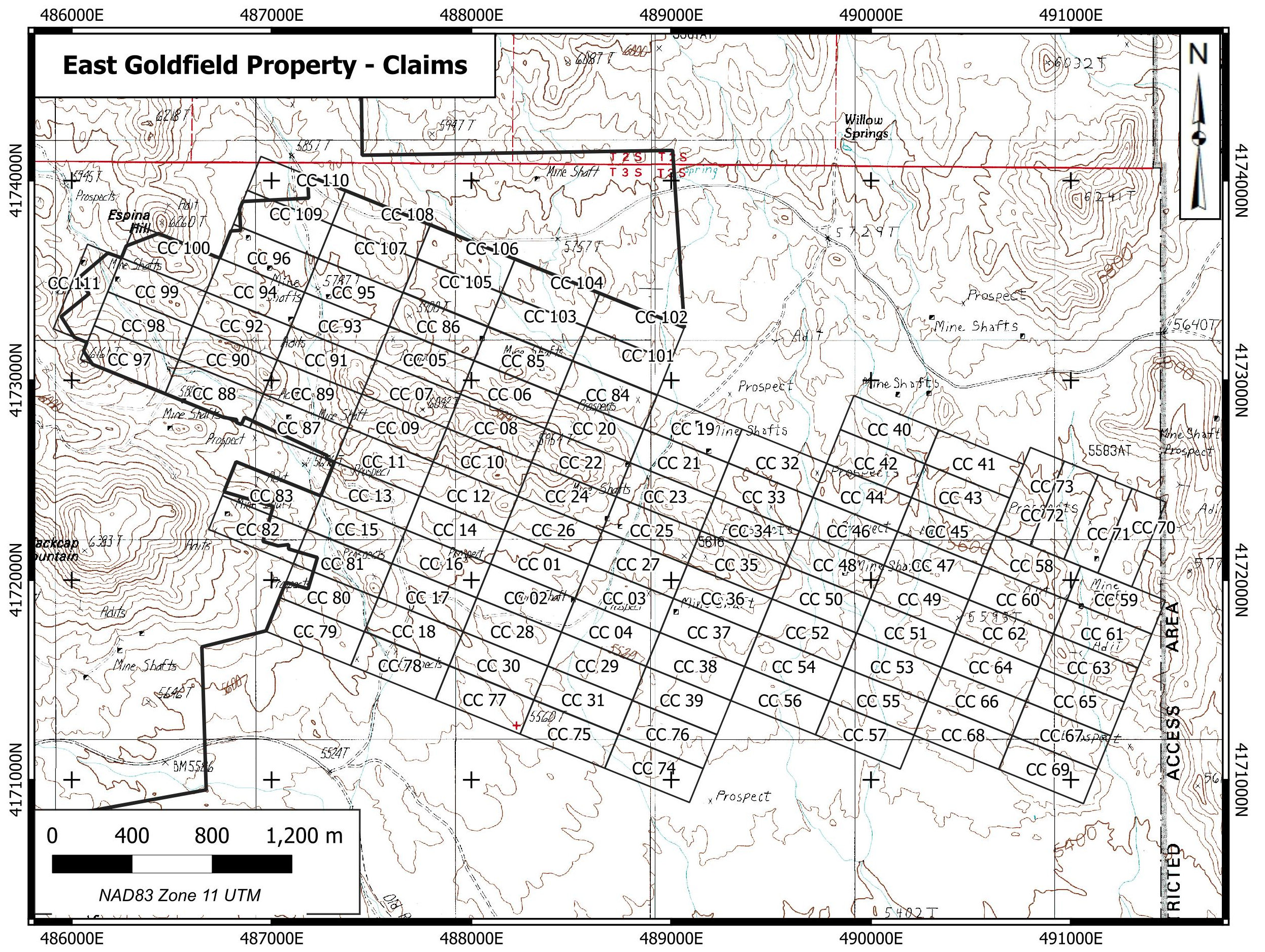
East Goldfield is a high sulphidation gold target 12 km east of Goldfield, Nevada. The property is centred at 37º 41’ 56” N 117º 7’ 41” W in Section 11, Township 3S Range 43E, Nye County, NV. The East Goldfield Project is accessible from Goldfield by road with a 4WD vehicle. The property currently consists of 110 Federal Lode Claims, sandwiched between Centerra Gold Corp.’s Goldfield Property and the Nellis Test Site (Air Force bombing range).
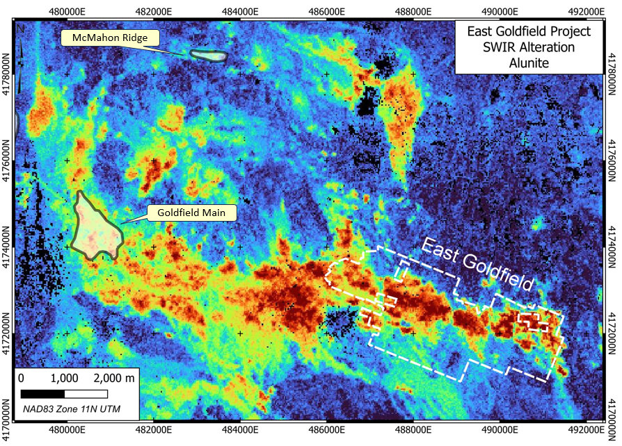
High grade gold mineralization was discovered at Goldfield in 1902 and mining was conducted continuously in the Goldfield Main area until 1952 and continued intermittently to this day at several small operations. Production to date from the district is approximately 4.2 M oz Au. Gold in the Goldfield District is found in residual (vuggy) silica ledges and replacements in permissible horizons in the Milltown Andesite, the Goldfield Dacite and underlying units. Quartz alunite alteration associated with the deposits is extensive and defines the structural controls on ore deposition. These include a circular fracture ring centred on a presumed buried intrusive body east of Goldfield and a linear feeder system connecting to the eastern margin of the circular fracture ring. The East Goldfield Project covers the linear fracture system.
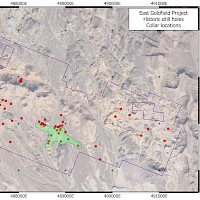
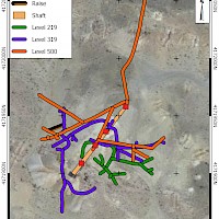
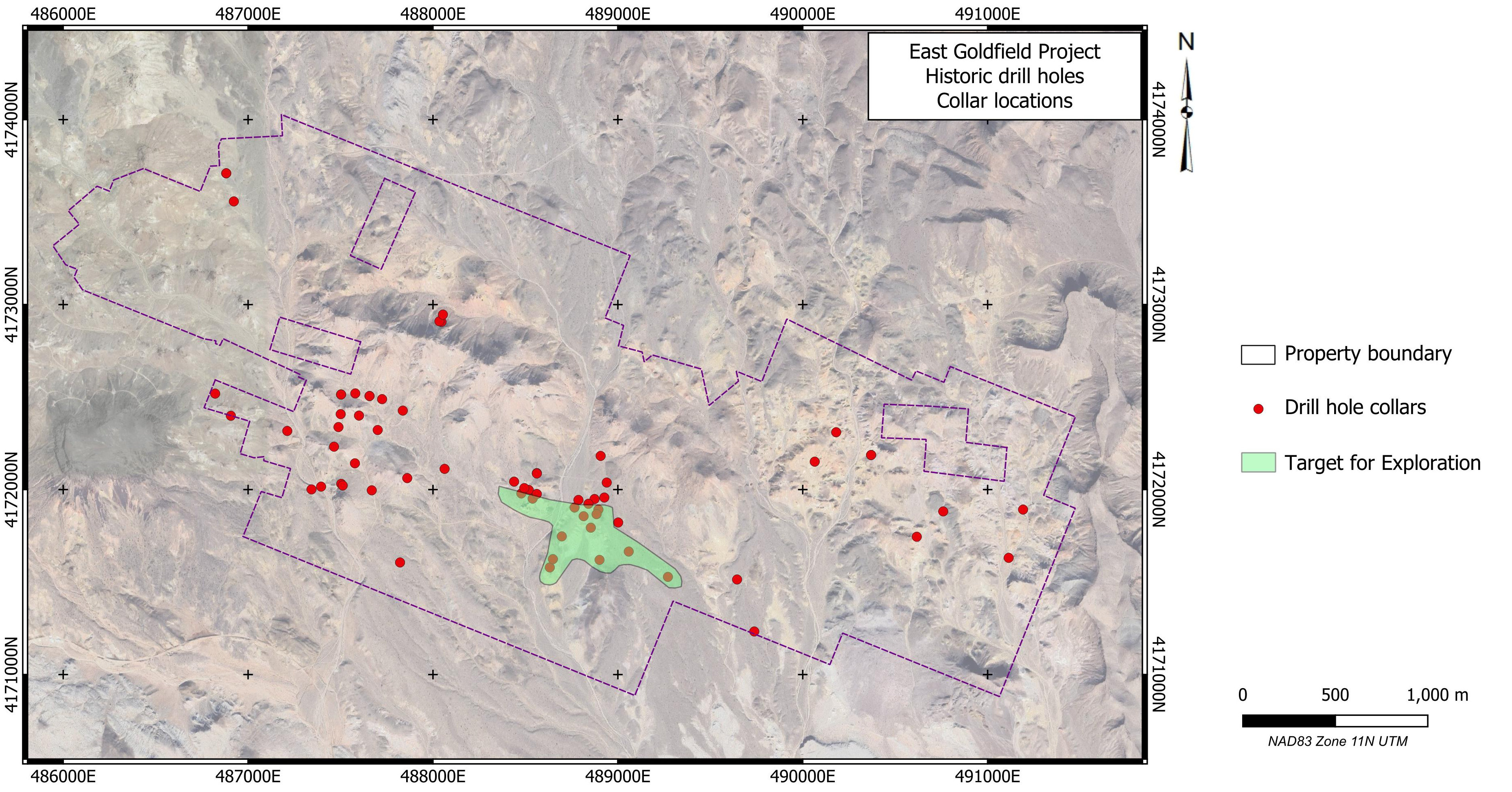
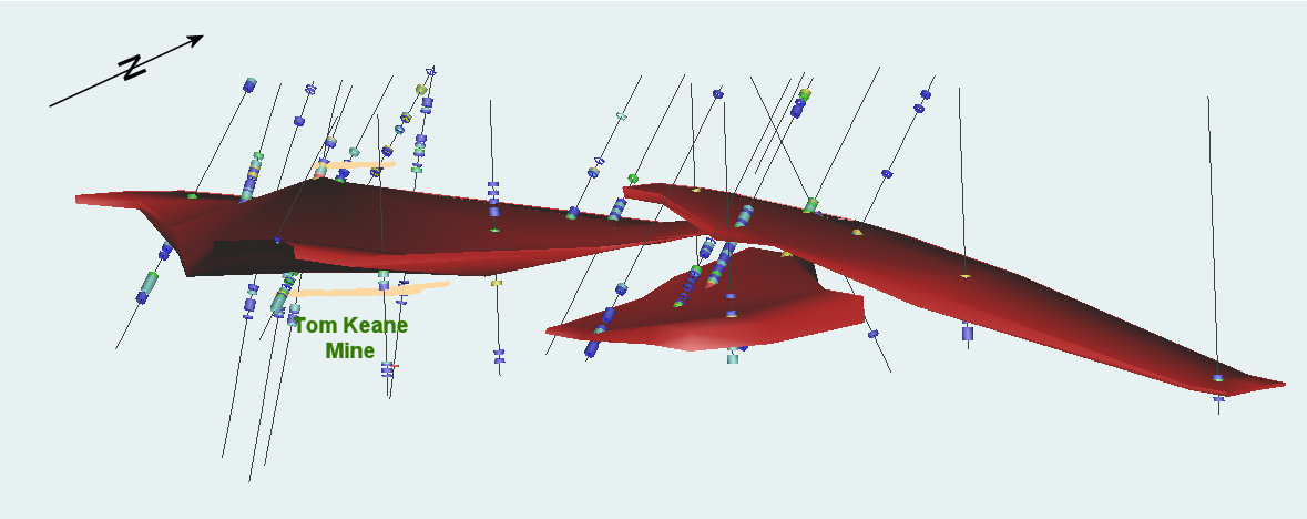
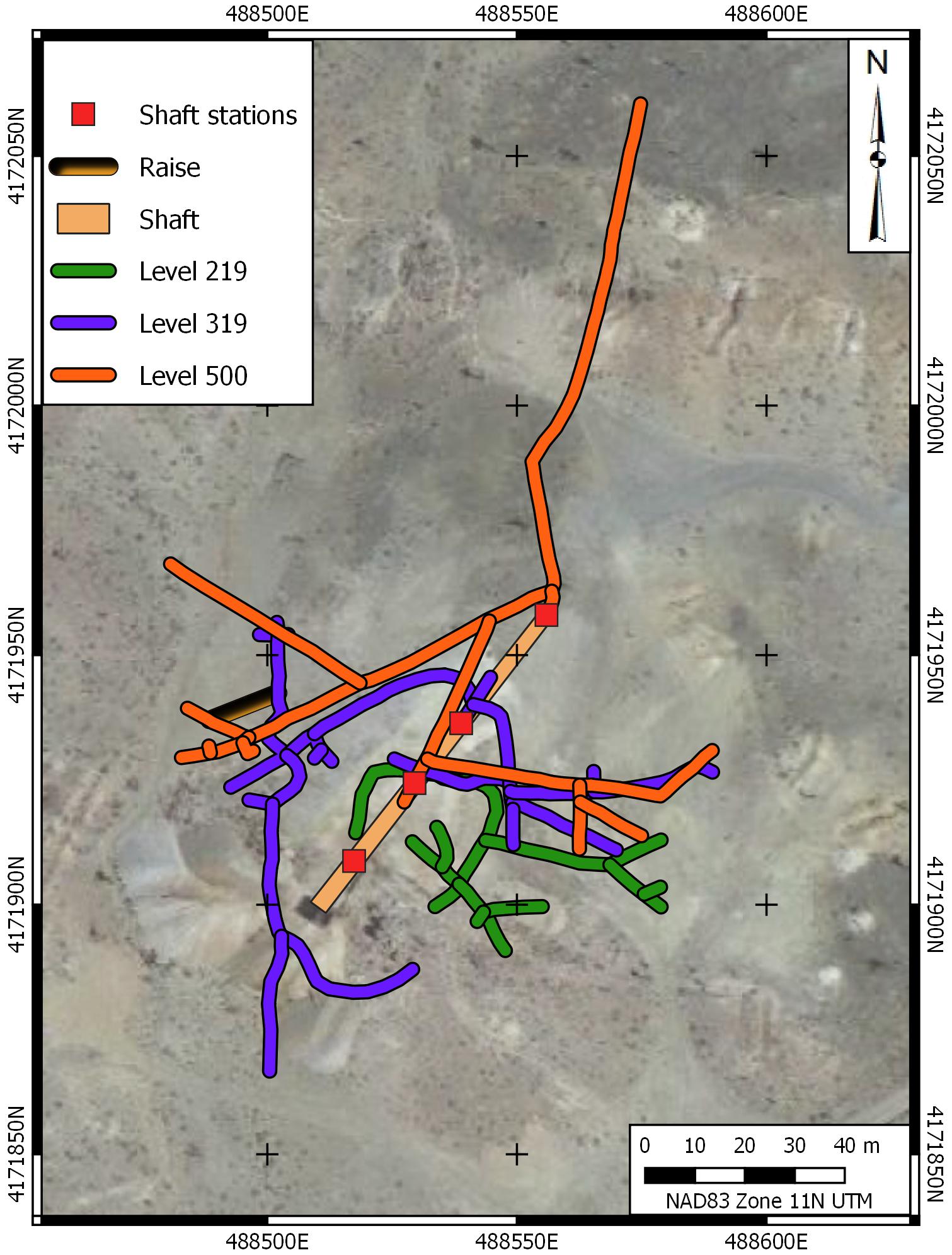
Exploration in the target area apparently dates from the time of the principal discoveries at Goldfield. The most significant workings are at the Tom Keane Mine which was developed prior to 1931 and produced on a minor scale by leasing. Workings at the mine consist of a 500-foot inclined shaft and 2860’ of drifting on 4 levels. A 1934 examination report documented samples returning 11.6 m @ 2.88 g/t Au on the 219 level and 3.04 m @ 4.11 g/t Au on the 319 level. Recent exploration in the property area was conducted by Noranda, Cameco, Romarco Minerals, Metallic Gold Ventures and Chapparal Gold Corp. before the property was allowed to lapse when Chaparral was subjected to a hostile takeover. Historic drill results on the property include up to 4.57 m @ 8.23 g/t Au, 1.5 m @ 36.28 g/t Au & 3.0 m @ 5.30 g/t Au and long intervals of mineralization including 22.9 m @ 2.88 g/t Au, 44.2 m @ 1.03 g/t Au and 20.5 m @ 1.22 g/t Au . Silver Range staked the Tom Keane Mine in 2018 and conducted geological mapping; prospecting; stream sediment and soil geochemical surveys; and alteration mapping in the area during 2018 and 2019. Silver Range optioned the property to ATAC Resources Ltd. in 2020 who conducted extensive surface exploration and drilled 13 holes before returning the property to Silver Range..
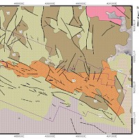
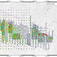
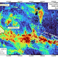
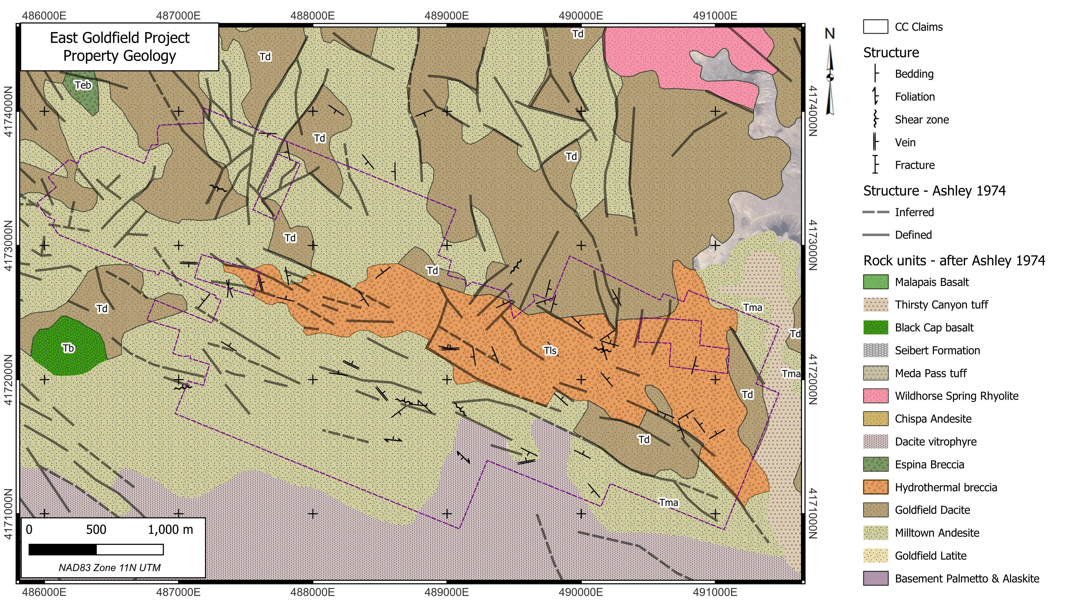
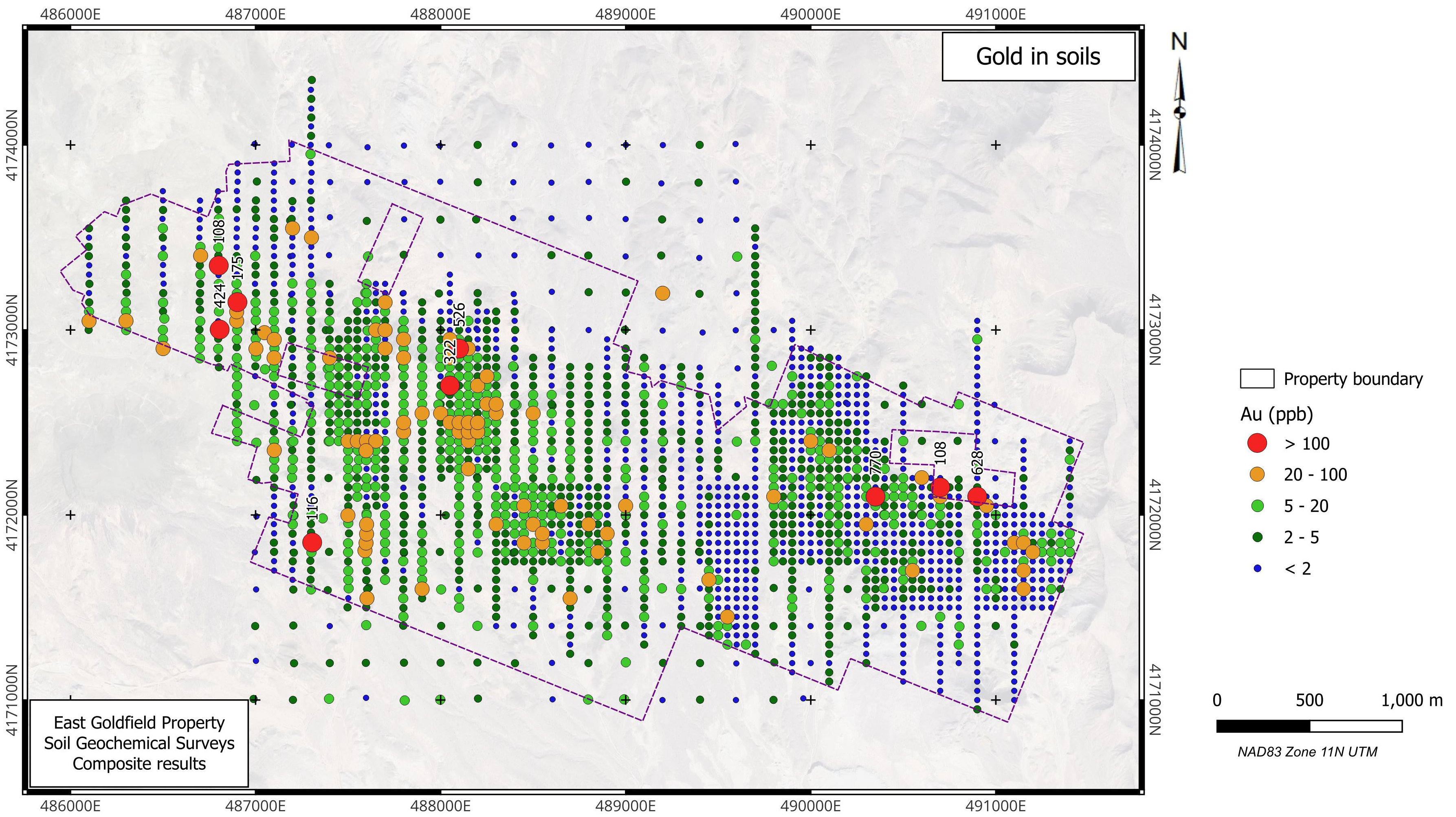
Mapping by the USGS in the early 1970’s in the East Goldfield Project area shows the area is underlain by Milltown Andesite, Goldfield Dacite and a hydrothermal breccia. The breccia is intensely altered and contains clasts of both the Milltown Andesite and the Goldfield Dacite. Stream sediment and soil geochemical anomalies indicate that this unit is weakly anomalous in gold, silver, bismuth and copper – key pathfinder elements for high sulphidation deposits. The Tom Keane Mine is on the southern margin of the breccia unit. The property is centred on an intense alunite anomaly defined by hyperspectral imagery. Alunite is a key characteristic alteration mineral found in high sulphidation systems.
Silver Range believes that the breccia unit is a hydrothermal breccia, perhaps an altered cataclasite unit. Hydrothermal breccias are found with most high sulphidation deposits and often host high grade gold mineralization. The tops of fully preserved high sulphidation systems are frequently barren, with at best only weak overlying geochemical leakage anomalies. Silver Range is focusing exploration on the hydrothermal breccia and adjacent Milltown Andesite and Goldfield Dacite, seeking a blind deposit along the structural corrido
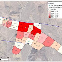
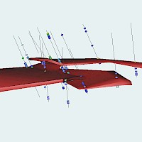
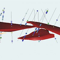
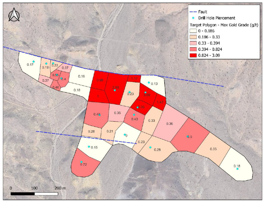
In 2025, Silver Range obtained historic data describing the 1993 to 1995 work program conducted by Cameco and containing additional earlier drill data. With this and ATAC drill data, Silver Range has been able to define an Exploration Target in the area of the Tom Keane Mine of from 2.26 to 6.0 Mt, grading between 0.34 to 0.62 g/t Au, containing 55,000 to 72,500 ounces of gold. A key insight from this work was the recognition that the gold-bearing horizon on the property is very gently dipping to flat at a depth of 150 to 180 m over much of the property.
Readers are cautioned that the quantity and grade of the Exploration Target are conceptual in nature, and there has not been sufficient exploration to define a mineral resource, and it is uncertain if further exploration will result in the target being delineated as a mineral resource. The Exploration Target Model has not been evaluated for reasonable prospects of eventual economic extraction.