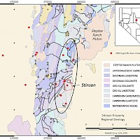
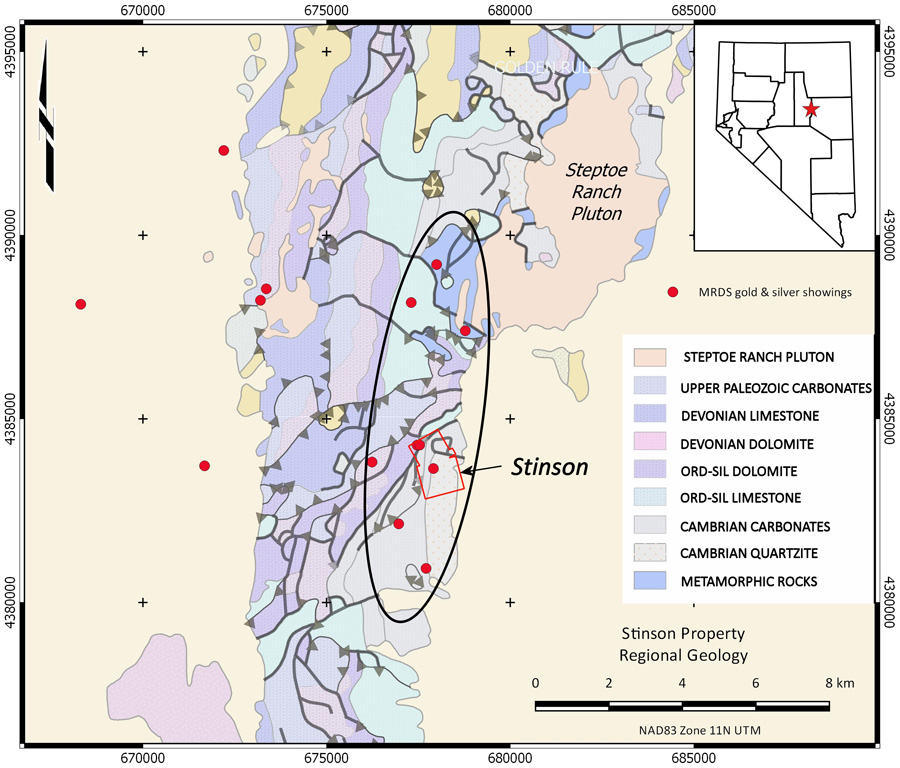
The Steptoe Project is centred at 390 36’N 1140 56’ W in the Egan Range, approximately 38 km north of Ely in White Pine County. The project consists of 41 claims in 6 claim blocks covering 8 Mineral Resource Data System showings in an overall area of approximately 50 km2. Silver Range staked claims covering the Ben Hur and Stinson Mines in 2016 and explored the properties in 2017. In November 2020, the Company expanded its area of interest, staking an additional five claim blocks covering other targets of interest. Silver Range began a stream sediment geochemistry program concurrently with staking the new claims and completed the geochemical survey in June 2021.
The target at the Steptoe Project is a sediment-hosted / Carlin-style deposit, similar in style to the Long Canyon (162 km to the North) and Kinsley Mountain (83 km to the northeast). The gold occurrences at the Steptoe Project are associated with north-striking faults and contacts in a 9 km trend terminating in the Steptoe Ranch Pluton. The Steptoe Ranch Pluton has been dated at 38 Ma, in the same time window as the deposition of mineralization in the Carlin Trend to the northwest.
Stinson Property
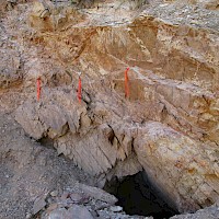
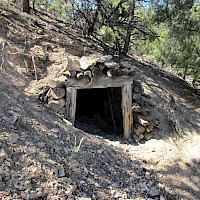
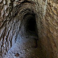
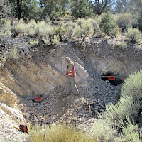
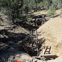
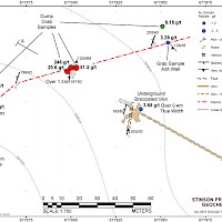
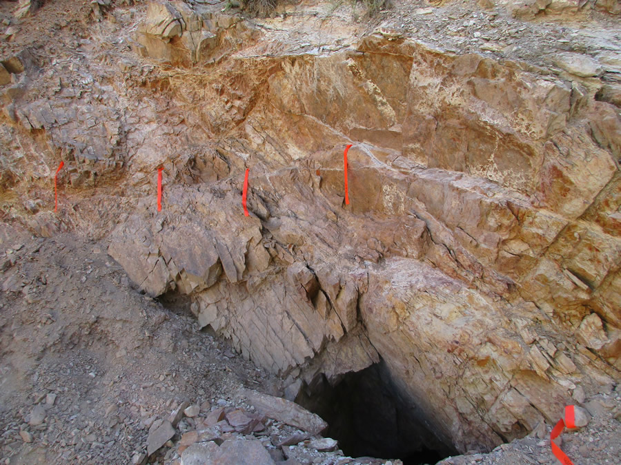
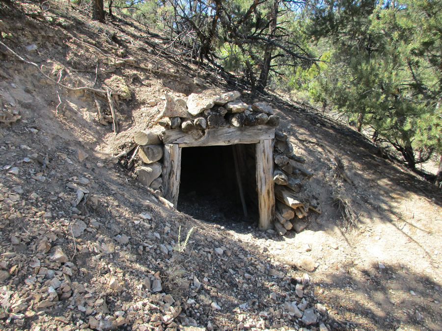
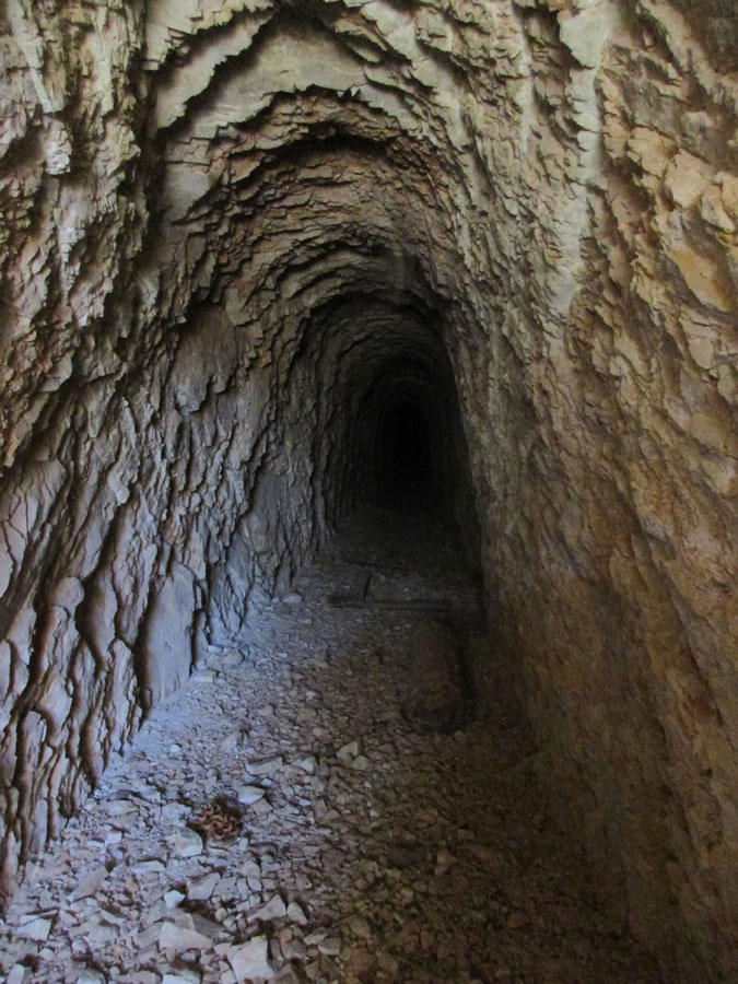
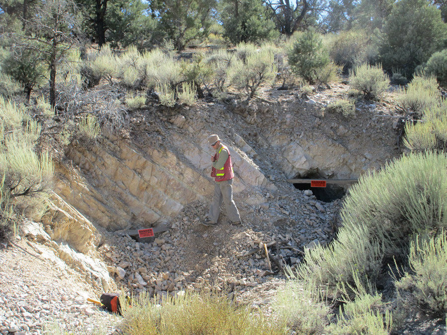
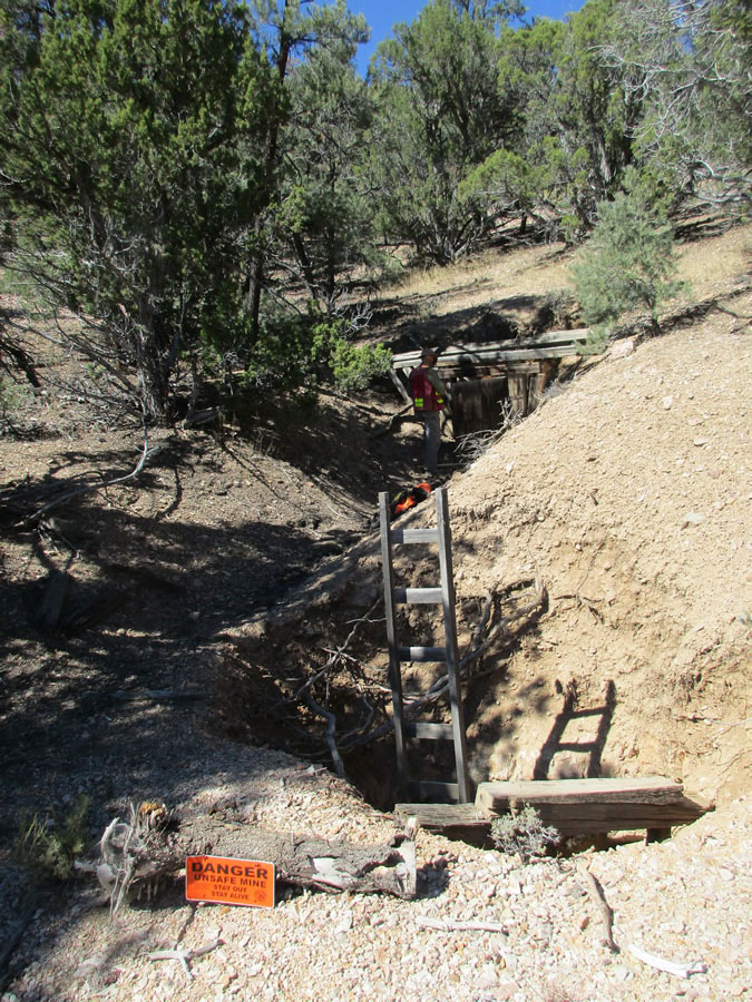
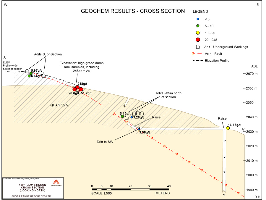
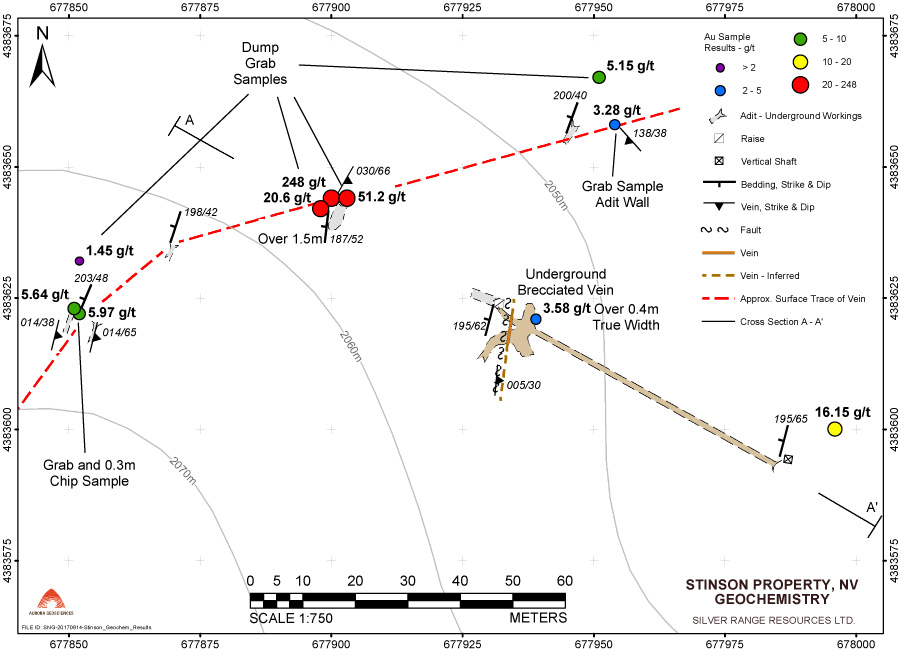
Stinson Property (part of the larger Steptoe Project) consists of 19 claims (STINT & HURT) covering MRDS showings M031255 (Stinson Mine) and M233767 (Old West Group). The latter appears to be the location of the Ben Hur Mine based on the extensive workings at the site and historical descriptions of its location. At the Stinson Mine, gold occurs with quartz veins in a southwest striking, moderately east dipping shear zone in Ordovician to Silurian carbonates. Sampling at Stinson during 2016 returned best results of 6.94 g/t Au from a grab sample and 3.8 m @ 2.57 g/t Au including 1.6m @ 8.16 g/t Au in a chip sample across the shear zone. Three of 15 samples collected at Stinson returned more than 1 g/t Au. At the Ben Hur Mine, work in 2016 and 2017 defined a north striking, gently east dipping shear zone with quartz veining and hematite alteration cutting Cambrian quartzite. The shear has been traced for approximately 100 metres on surface and was intersected in underground workings 40 m down dip from the surface exposure. Surface grab sampling returned up to 248 g/t Au with 7 of 27 samples collected at Ben Hur returning greater than 1 g/t Au. A chip sample across exposed surface mineralization near the highest-grade grab sample returned 1.5 m @ 20.6 g/t Au. Grab samples from dump material at workings along the vein 50 metres southwest and northeast of this location returned 5.97 g/t Au and 5.15 g/t Au respectively. The shear zone is exposed underground in a cross-cut 40 metres east and down-dip of the surface exposures. Chip sampling of the partially exposed vein here returned 0.4 m @ 3.58 g/t Au. The crew was unable to sample mineralization in the production stopes because of poor ground conditions.
Other showings & work
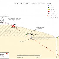
In November 2020, Silver Range staked 7 other MRDS showings in the area extending from south of the Stinson Property north to the Steptoe Ranch Pluton. A fine-fraction stream sediment geochemical survey was completed throughout a 47 km2 area of interest including the claims in the Steptoe Project in June 2021. Grab samples collected during this program returned analyses up to 5,240 g/t Ag and 24.6 g/t Au. Further exploration is planned to follow-up and refine targets of interest resulting from this work.