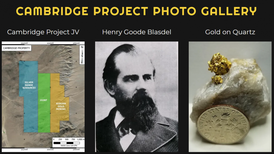
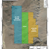
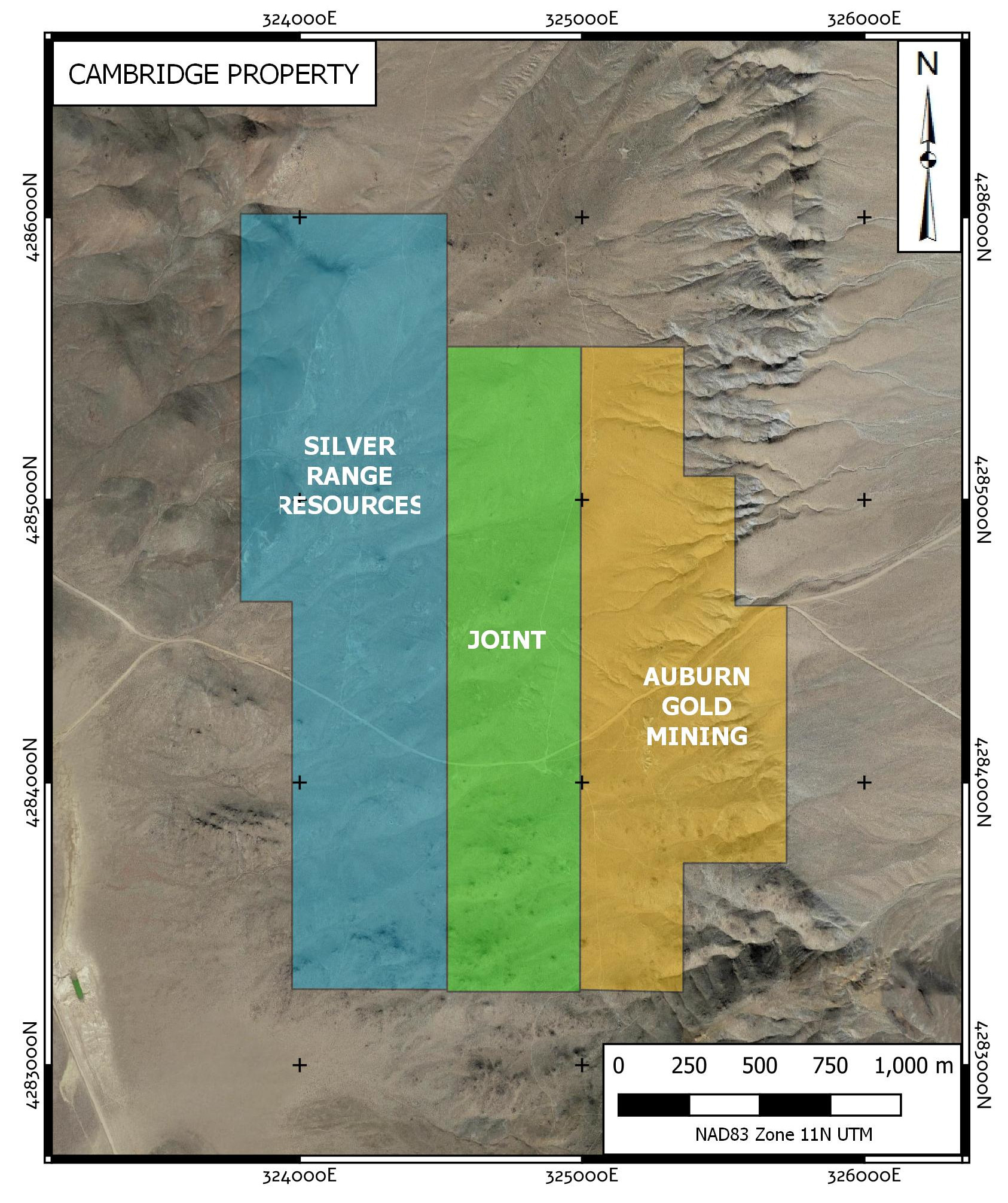
The Cambridge Property is located 33 km south of Yerington in Lyon County, NV. It consists of 51 Federal Lode Claims staked in Sections 25 & 36 Township 10N Range 26E, MDM and Sections 30, 31 Township 10N Range 27E, MDM. The property is readily accessible by road from State Route 3C and the East Walker Road which runs across the southern boundary of the claims. Silver Range staked the Pilot Lode workings adjacent to the Cambridge Mine in 2016 and Auburn Gold Mining LLC staked the Cambridge Mine in 2019. The two companies formed a joint-venture to consolidate and explore the district in 2020.
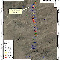
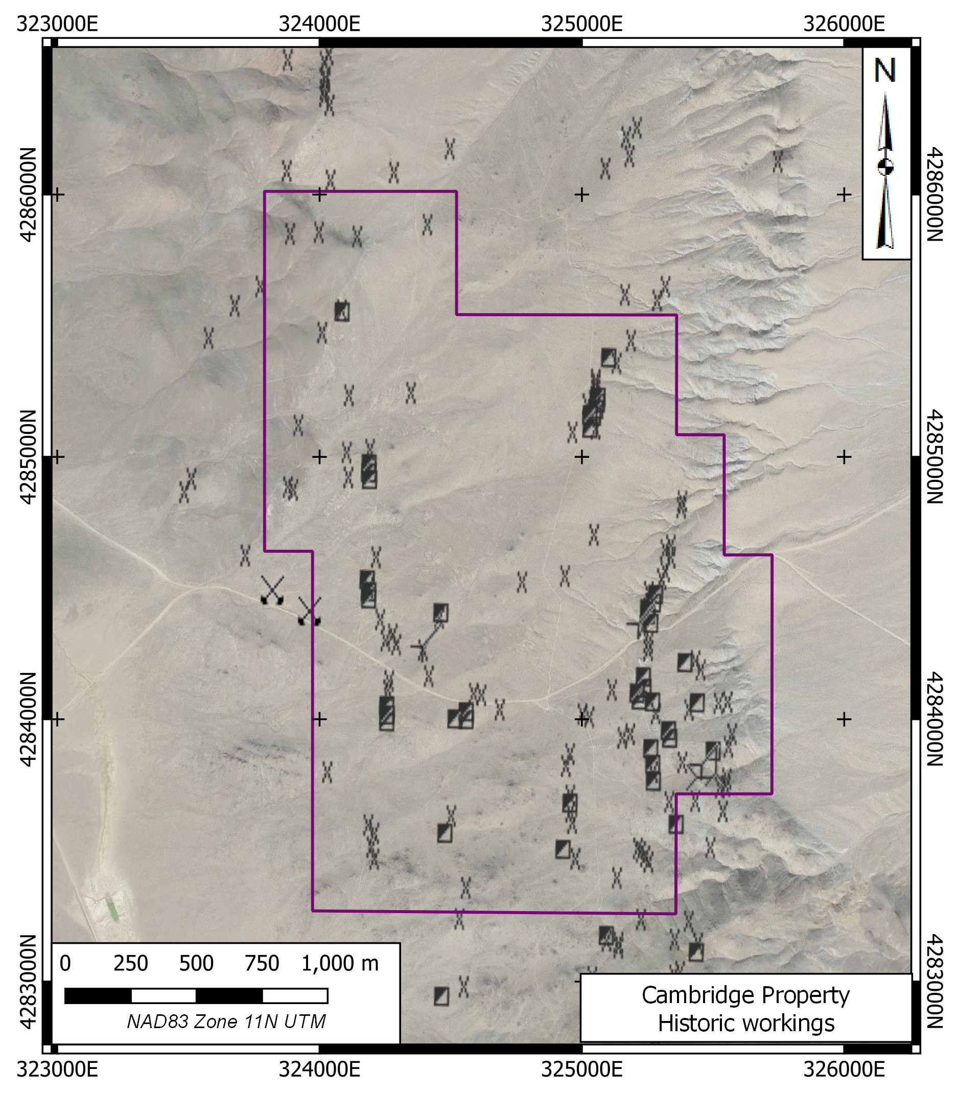
Mining in the district dates from the 1860’s but took off when Henry Blasdel, Nevada’s first state governor, purchased the Cambridge Mine in the southeastern portion of the Cambridge Property in the late 1870’s. Development at that time consisted of a shaft sunk to 250’ and a comparative amount of drifting on two levels. Approximately 10,000 tons of ore grading approximately 0.3 OPT Au was extracted during this period and processed at a nearby mill on the Walker River. The operation shut down in the late 1800’s and was briefly reactivated by the Cambridge Mining Corp. from 1940 to 1942, closing when all gold mining was shut down by order of the Federal Government. Ernest Rink, the mill foreman, staked a number of properties in the area including the Contact Group which was explored briefly in the 1960’s. There is no record of recent major company activity in the area.
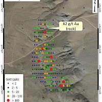
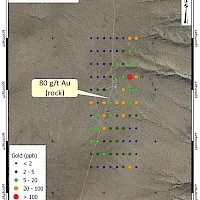
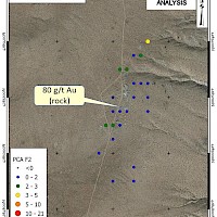
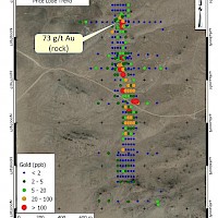
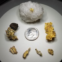
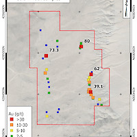
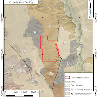
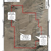
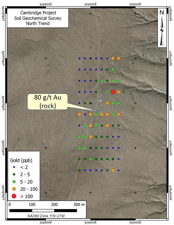
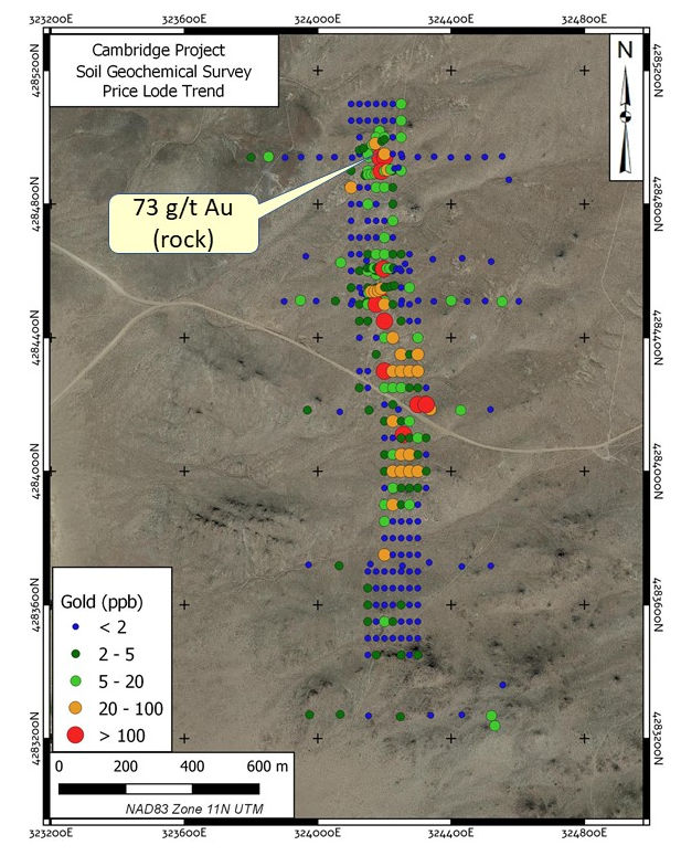
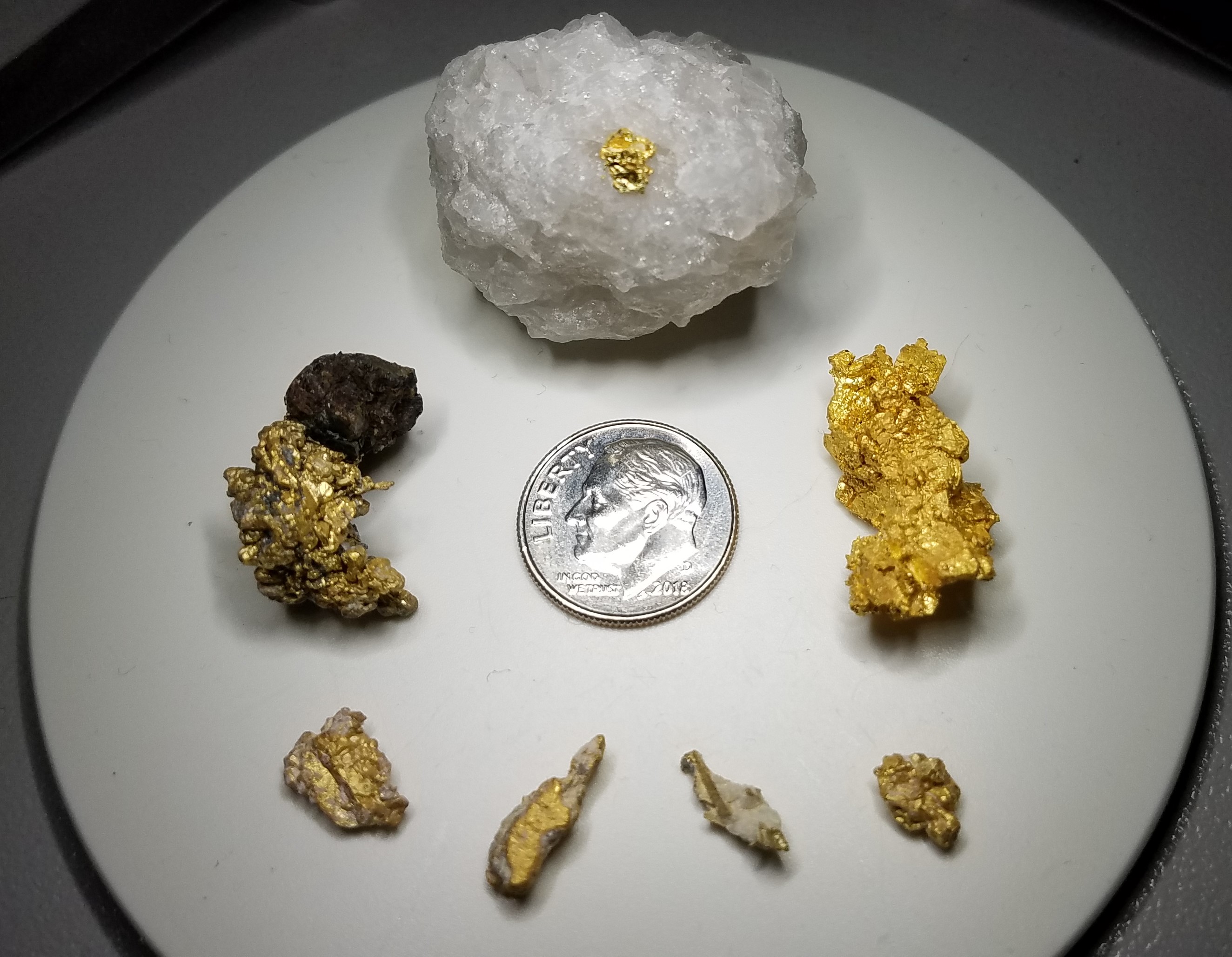
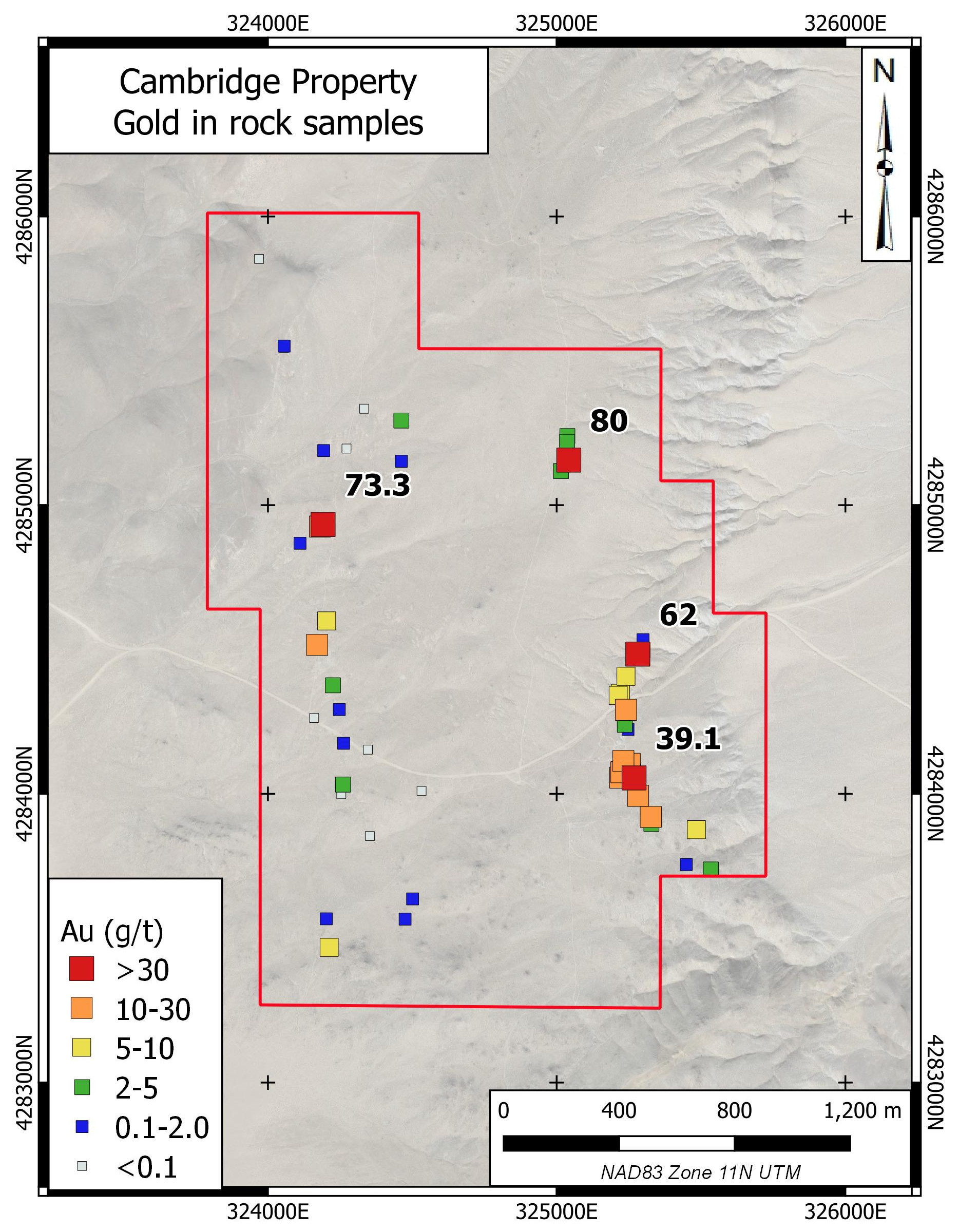
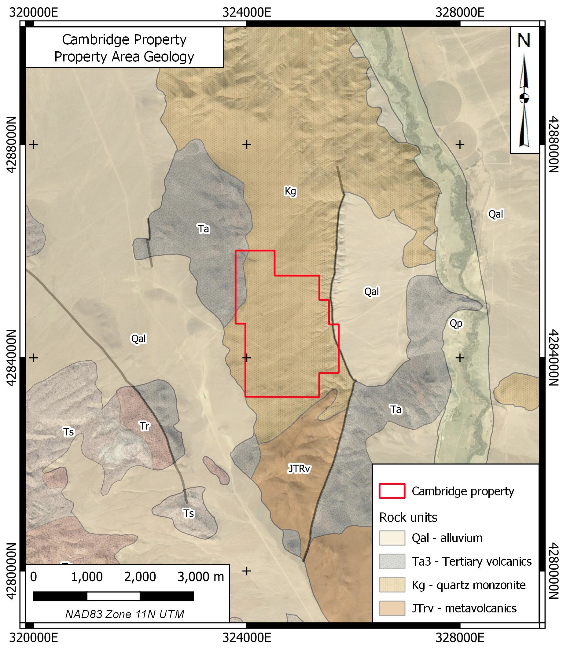
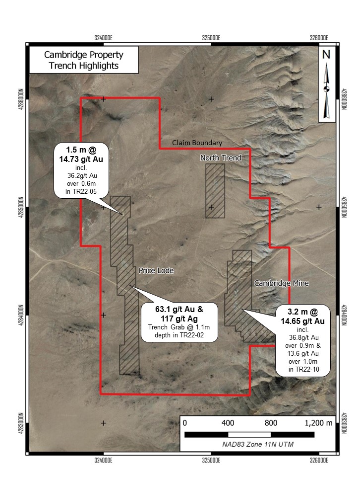
The Cambridge Property is underlain by Cretaceous quartz monzonite overthrust by Tertiary andesite in the northwestern corner of the property. Outcrop is sparse on the property but there is no indication of deep overburden with sparse bedrock outcrop common throughout the claims. The quartz monzonite is medium to coarse grained and is cut by north to north-northwest trending, apparently steeply-dipping faults or shears which host the gold mineralization. The mineralization located to date consists of quartz veins up to 20 cm wide in the few exposed areas and reportedly up to 2.0 m in some mine workings. The quartz is coarse grained, locally laminated and carries disseminated pyrite, pyrrhotite, chalcopyrite and rare galena, tetrahedrite and amorphous black sulphides. Most sulphides are weathered and pyrite boxworks, malachite and rare yellow cerrusite together with limonite and hematite are more common. The selvages of the veins are clay altered but not significantly more than the surrounding bedrock. The property is distal from any volcanic centres and the style of mineralization is interpreted to be mesothermal. Grab sampling on the property to date has recovered 68 samples with 20 (29%) assaying greater than 5 g/t Au and the best sample returning 80.0 g/t Au. The Cambridge Mine was noted for visible gold and this been recovered from waste dumps samples at the Cambridge Mine.
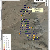
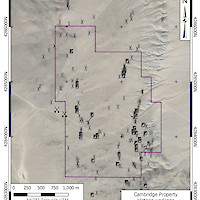
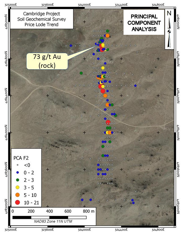
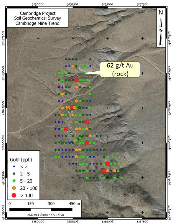
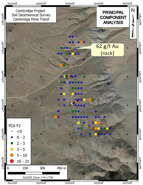
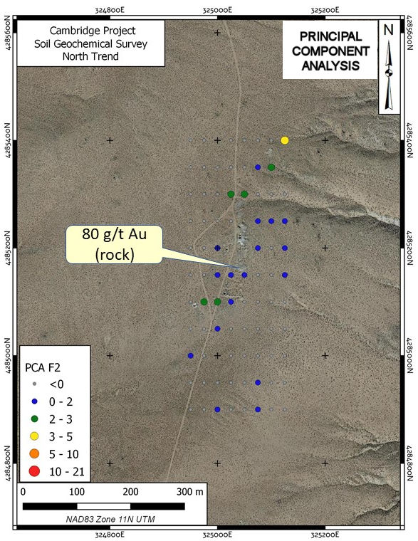
An airborne total magnetic field and radiometric survey was conducted on the property in 2020. The total magnetic field data in particular delineated trends coincident with known bedrock gold mineralization in the western portion of the property. Orientation soil surveys conducted on the property in late 2020 defined parameters for a property-wide survey capable of detecting the known bedrock gold mineralization. Silver Range and Auburn Gold Mining intend to conduct geophysical surveys and trenching, within the recently defined geochemical anomalies to locate gold mineralization on the property. This would be followed by drilling.