The Cold Springs property is located 80 km east of Fallon and 66 km west of Austin in Churchill County. Supernova Metals Corp. (CSE:SUPR) has acquired a 100% interest in the Property with Silver Range retaining a 2.5% Net Smelter Return (“NSR”) Royalty of which 60% can be repurchased for $1,250,000.
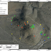
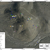
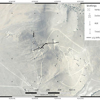
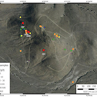
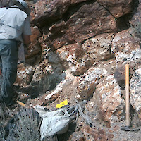
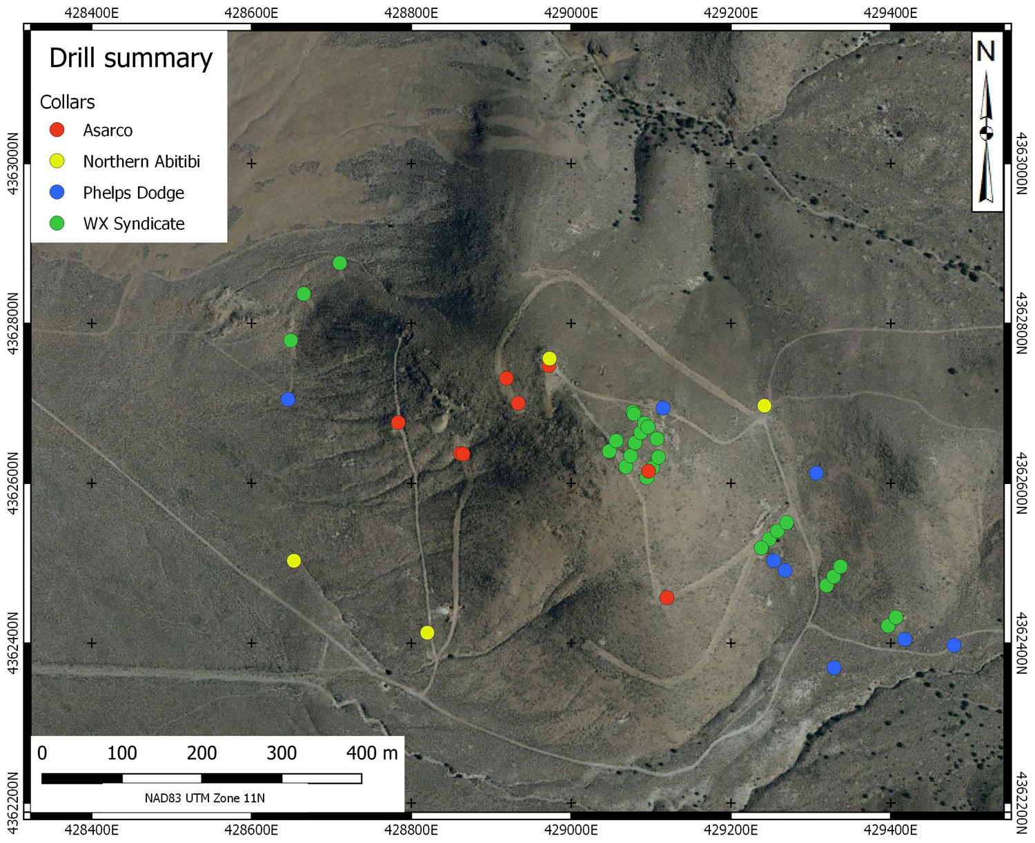
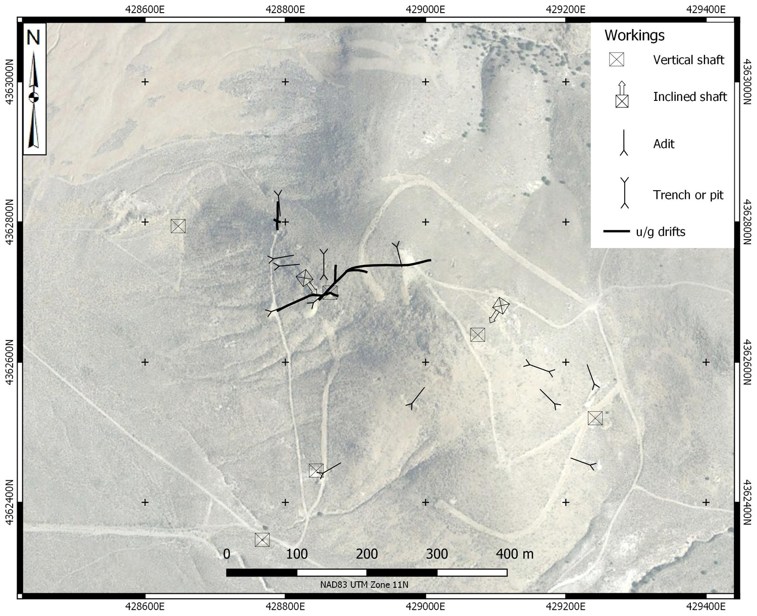
Records from 1935 indicate that the property was explored since the 1860’s while staking records date from 1907. It was explored intensively by G. Peer from 1950 to 1980 with 400’ of shaft sinking, 2000’ of underground drifting and CAT trenching. There have been four rounds of drilling on the property: Phelps Dodge (1981), ASARCO (1983), WX Syndicate (1987-88) and Northern Abitibi Mining (2006-2007) with a total of 47 holes completed. The property was restaked by Silver Range in 2016 and explored by prospecting, sampling, geological mapping and geophysical surveys in 2016 and 2018.
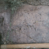
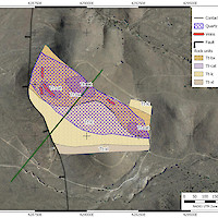
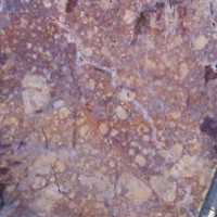
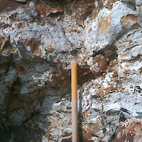
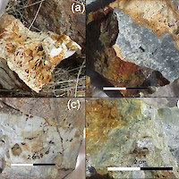
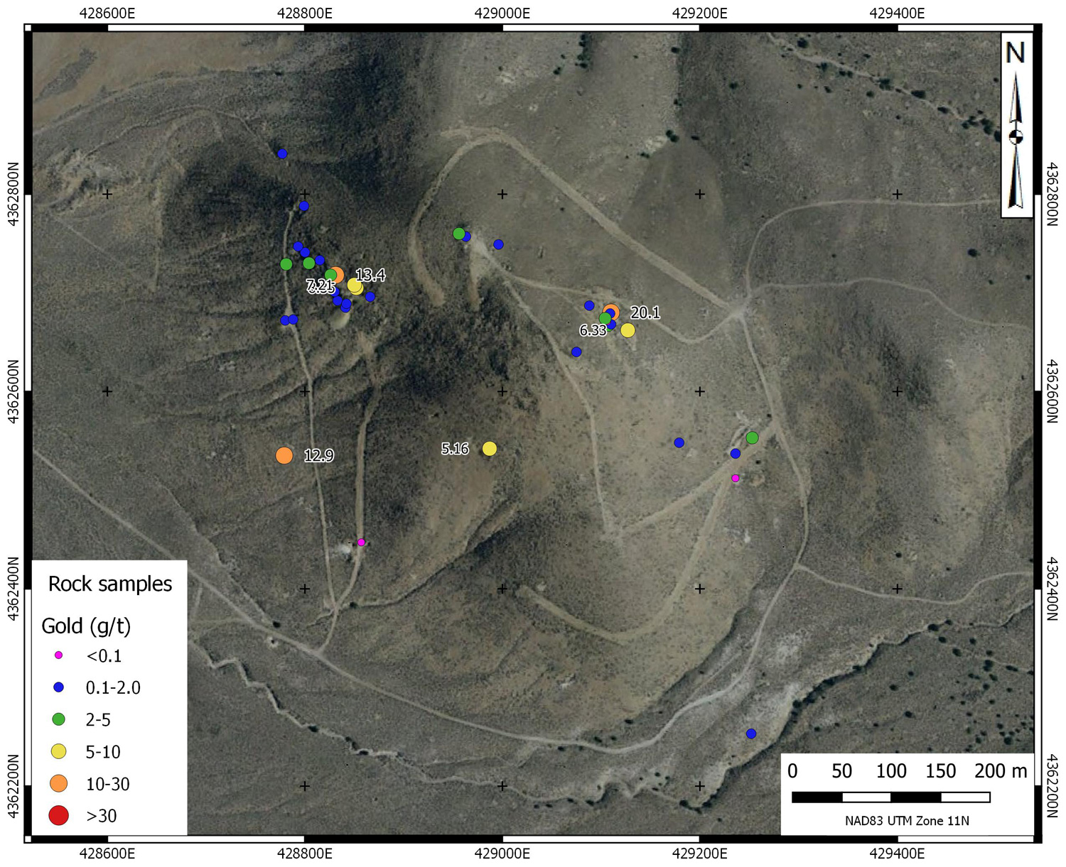
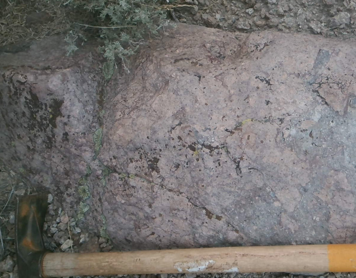
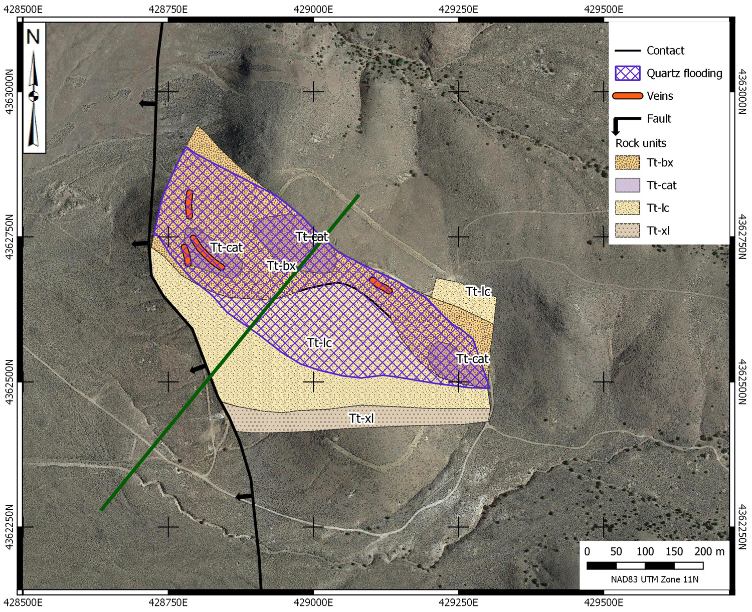
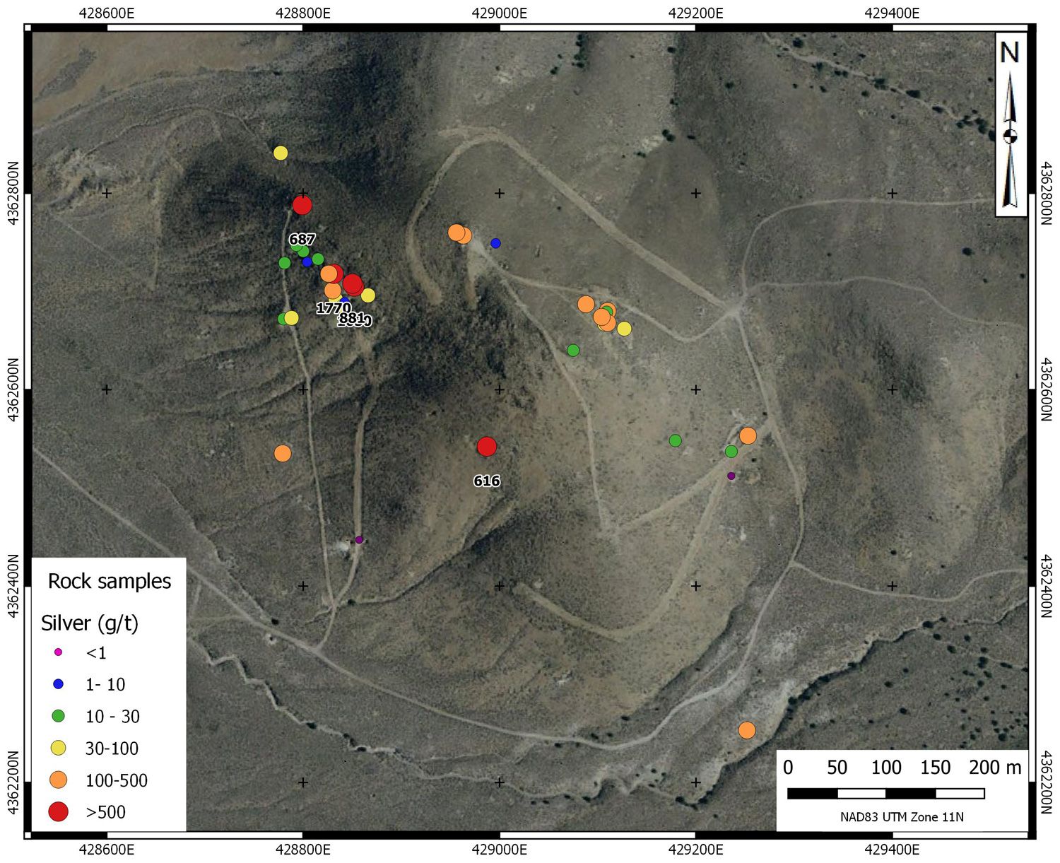
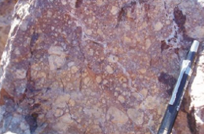
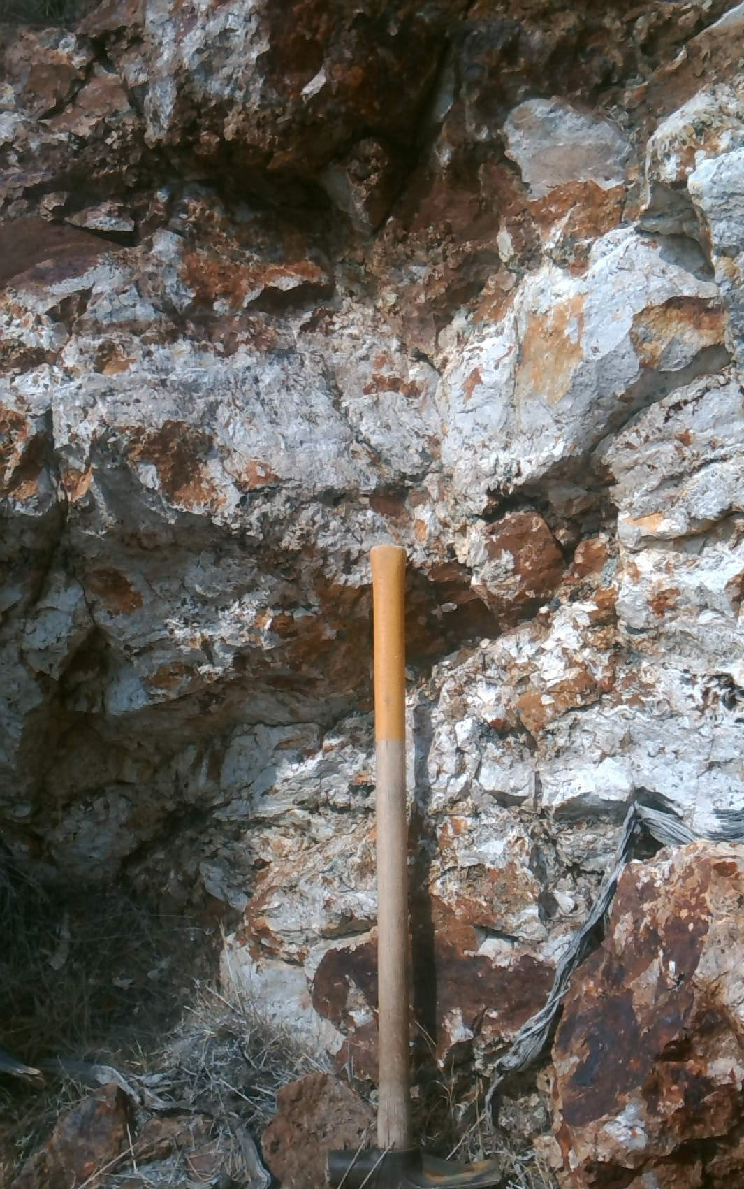
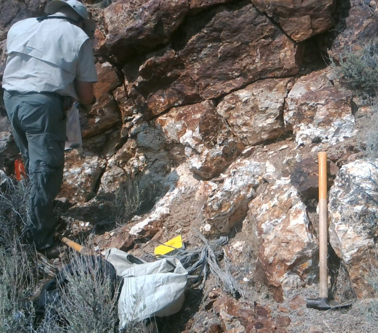
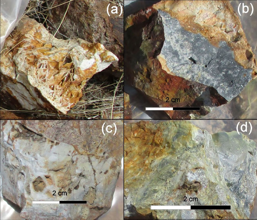
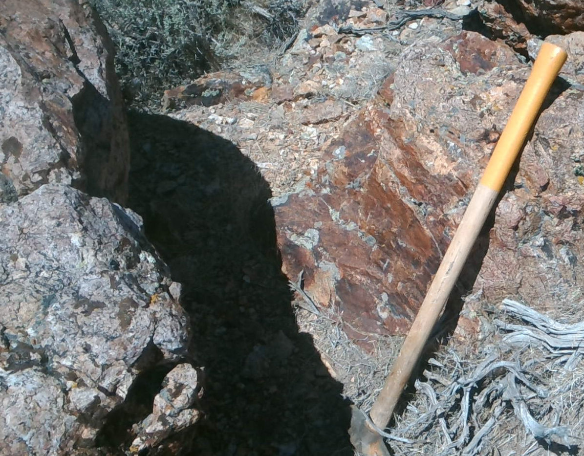
The property is underlain by a west to southwest dipping sequence of rhyodacitic tuffs, grading from a crystal tuff at lower elevations (Tt-xl) through a lithic-crystal tuff (Tt-lc)to a lithic tuff breccia (Tt-bx) capping the hill on which exposed mineralization is centred. The capping tuff-breccia is cut by internal cataclasites (Tt-cat), likely primary features generated during slumping of an over-steepened hot volcanic pile. Gold mineralization occurs in the upper unit and a portion of the underlying lithic-crystal tuff and consists of two phases of silicification. An early phase is wide spread, pervasive and consists of centimeter-spaced quartz veinlets and interstitial quartz flooding. This style of mineralization contains subeconomic gold and silver, averaging 0.113 g/t Au and 2.81 g/t where thoroughly drill tested in the centre of the property. The second phase of mineralization consists of quartz-chalcedony veins, exposed for up to 70 m in the west face of the central hill and up to 2 m thick. These are classic low sulphidation epithermal veins showing quartz after calcite (QUAC) texture, brecciation and annealing, ginguro banding and clots of pyrite and silver sulphides and sulphosalts. Historic grab sampling of these veins returned assays up to 64.9 g/t Au and 1,280 g/t Ag while initial sampling by Silver Range in 2016 returned grab samples up to 20.1 g/t Au and 1,770 g/t Ag from similar material. A vein drill intersection by ASARCO in 1983 (CS83-03) returned 3.05 m @ 4.25 g/t Au.
Silver Range has acquired and analyzed all of the known drill data from the property, covering the period from 1981 through 2007. The area under the central hill on which the high-grade mineralization has been exposed has been extensively tested at shallow depths and deeper holes have been completed to test for steeply dipping feeder veins beneath the hill. The drill data indicates that the precious metal mineralization is shallow, limited to elevations above 1750 m ASL. This finding, together with the fact that all of the major second stage precious metal veins are moderately west to southwest dipping indicates that the mineralization at Cold Springs is peripheral to a larger system, likely down the hydrothermal hydraulic gradient to the west.
Gold mineralization at Cold Springs is truncated on the west flank of the central hill by a north-striking range front normal fault which has down-dropped the western portion of the hydrothermal mineralization to the west. Drill holes west of the fault suggest that bedrock depths beneath alluvial cover are in the order of 60 to 80 m within 100 m of the fault trace. The maroon tuff breccia capping the hill at Cold Springs has been encountered in two angled drill holes; these cut hanging wall rocks, passed through the fault and were completed in barren footwall rocks east of the fault.
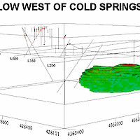
In October 2018, Silver Range completed a three-dimensional induced polarization and resistivity survey over a grid centred west of the mineralization and extending for approximately 400 m west of the range front fault. This survey identified a large, compact zone of low resistivity (< 35 ohm-m) approximately 200 m west of the range front fault and west of exposures of second stage high-grade low sulphidation veins on the west flank of the central hill. This zone extends deeper than the detection limit of the survey (approximately 200 m below surface) and has a top at around 80 m, the inferred approximate depth to bedrock beneath alluvium in this area. This zone of low resistivity is interpreted to be a region of advanced argillic alteration enclosing the steeply dipping source of the hydrothermal system which includes the high-grade vein exposures on the central hill. Silver Range considers this zone of low resistivity to be a prime drill target, well supported by geology.